Imagine stepping outside for morning coffee as dolphins surface in the Manatee River or capping the day with a sunset over Palma Sola Bay. If you’re weighing a move to Bradenton to be closer to the water, you want the lifestyle and you also want to buy smart. In this guide, you’ll see how each waterfront option actually lives, where the trade-offs show up, and what to check before you write an offer. Let’s dive in.
Waterfront options in Bradenton
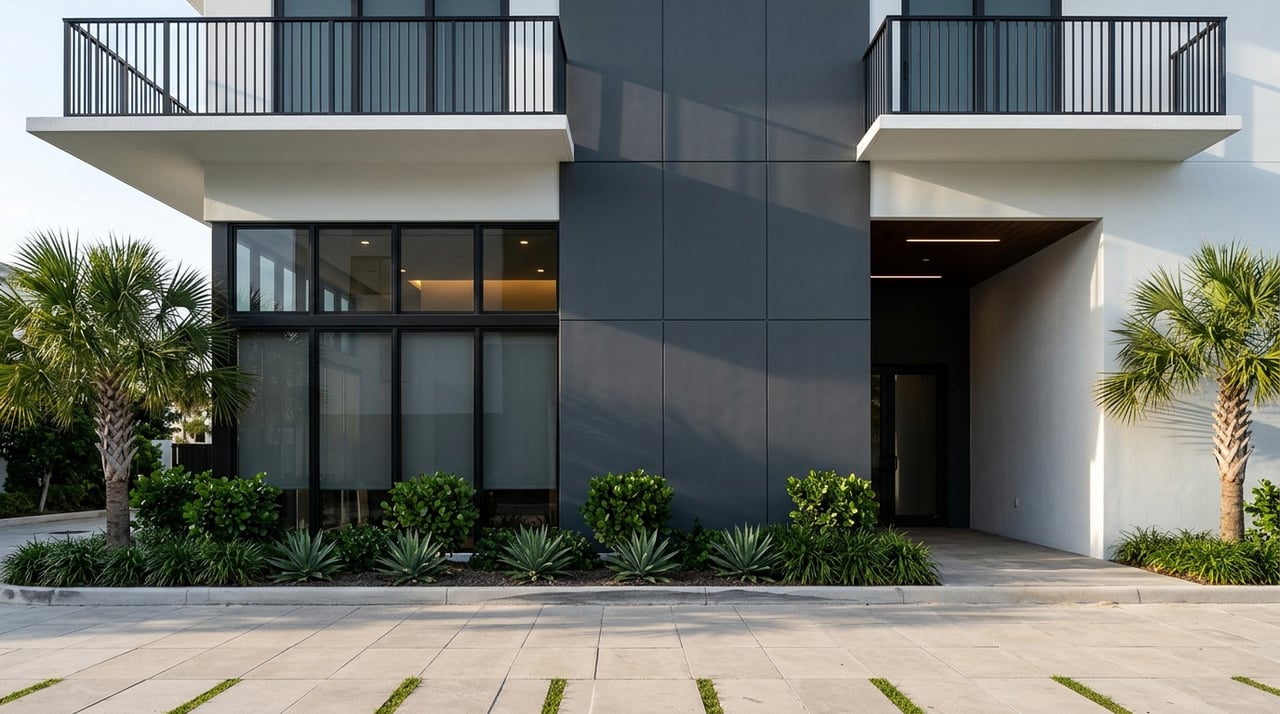
Riverfront: walkable energy and marinas
Riverfront living centers on the Manatee River, especially near downtown and the Riverwalk. You get quick access to dining, arts, and events, plus day docks and a linear park that makes daily life feel connected to the water. The Bradenton Riverwalk is a major draw for river buyers who value walkability and community programming. Many homes and condos along the river include or are near marina options, which can simplify boating logistics.
Bayfront: sunsets and protected waters
Bayfront properties on Palma Sola and Sarasota Bay often feature seawalls and deeper-water docking with relatively calm, protected waters. If you run a shallower-draft powerboat or like nearshore fishing, bay frontage can hit a sweet spot. Manatee County also maintains public launch points, so friends can meet you on the water via county boat ramps. The feel is more residential than tourist-heavy gulf beaches, with wide views and frequent sunsets.
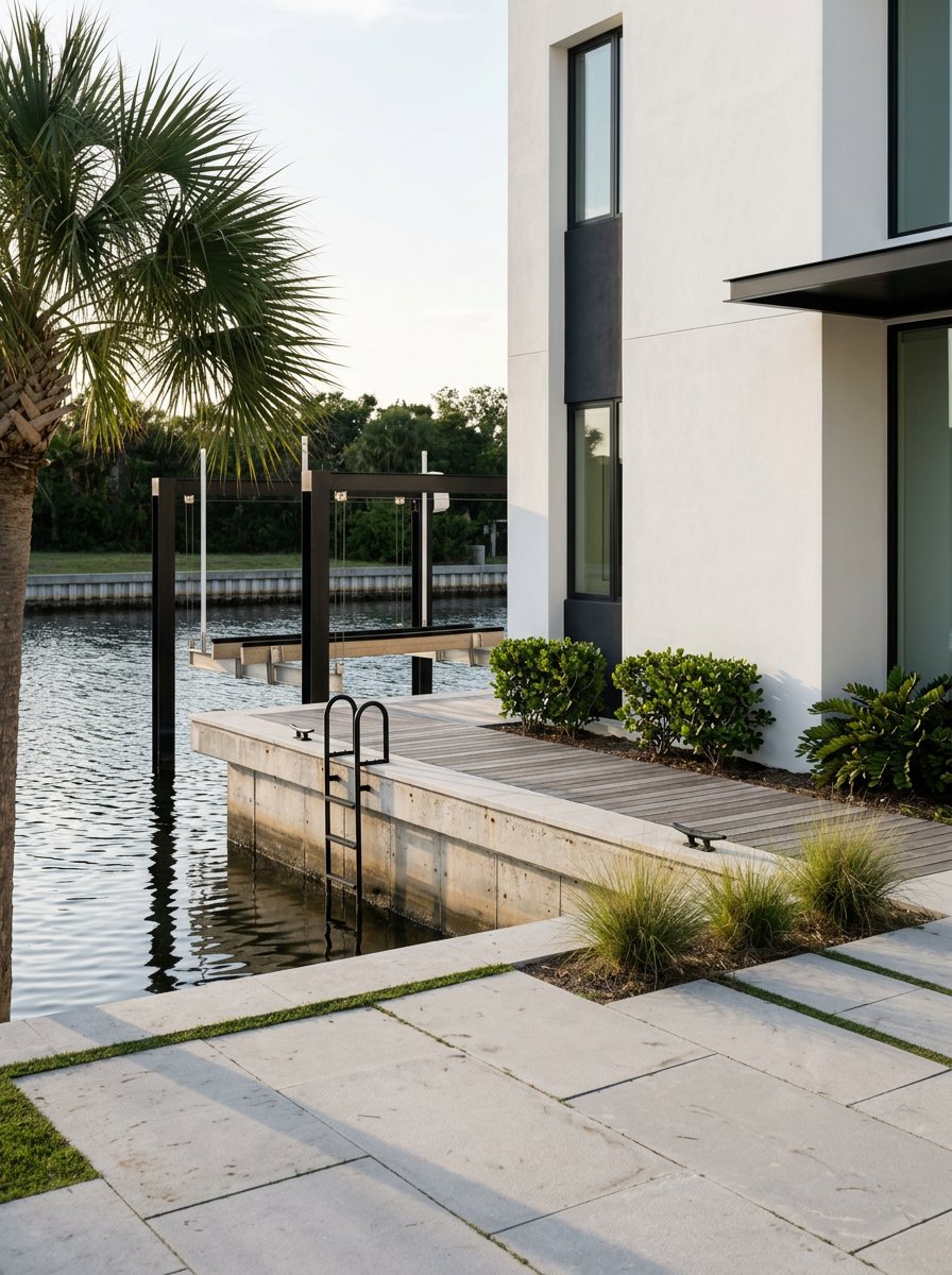
Canal-front: everyday boat convenience
Canal neighborhoods trade expansive views for protected moorage and stepped-right-off-the-dock convenience. Depth, tidal swing, and dredging history vary by canal, so you should confirm navigability and maintenance obligations before you buy. The Manatee County Water Atlas is a helpful reference point for regional water resources and environmental context. Many canal homes are mid-century ranch styles that have been updated with lifts, newer seawalls, or renovated outdoor living.
Gulf barrier islands: toes-in-the-sand access
True beach frontage sits across the bridges on Anna Maria Island and Bradenton Beach. If you want the sand and surf right outside, the barrier islands deliver it along with lively dining, seasonal events, and independent municipal rules. A passenger ferry now links downtown Bradenton with the Anna Maria City Pier and Bridge Street Pier, offering another way to reach the islands beyond bridge traffic, per recent ferry coverage. Expect premium pricing and a stronger tourism presence than in-city waterfront.
Freshwater lakefront: quiet and low-tide stress
Lake and pond frontage east of town offers fishing, paddling, and less tidal complexity than saltwater frontage. You’ll focus more on freshwater ecosystems and park access than on boating to the Gulf. It can be a good fit if you prioritize calmer water views and a more inland commute.
Quick compare: river, bay, canal, gulf, lake
| Waterfront type | Typical features | Boating access | Lifestyle feel | Practical notes |
|---|---|---|---|---|
| Riverfront | Mix of historic and newer homes, marinas nearby | Direct to bay and Gulf, some bridge clearances | Walkable to downtown and Riverwalk | Check flood zones and docking rights |
| Bayfront | Seawalls, deeper-water docks common | Protected bays, easy day boating, public boat ramps | Big sunset views, less surf exposure | Verify seawall condition and insurance |
| Canal-front | Private docks, lifts, protected moorage | Varies by canal depth and dredging | Quiet waters, practical boat storage | Review canal maintenance and water resources |
| Gulf/island | Beachfront condos and single-family homes | Open Gulf via passes; beach first, boating second | Sand-at-your-door, seasonal activity, ferry access | Stronger tourism, separate island rules |
| Lakefront | Freshwater views, park access | Fishing, kayaking, small craft | Low-tide stress, quieter setting | Different ecology and permitting norms |
Lifestyle highlights you will feel day one
Boating made simple
Between private docks, downtown marinas, and county ramps, you can get on the water quickly. The downtown Twin Dolphin Marina is a local anchor for boaters and waterfront dining; see the marina overview for slip types and amenities. If you trailer a boat or host guests with trailers, the county’s ramp listings are essential.
Riverwalk and downtown
If you want a daily connection to the river, the Bradenton Riverwalk concentrates green space, day docks, and community events into a mile-plus waterfront park. It is a signature amenity that shapes the feel of in-town riverfront living.
Fishing, wildlife, and sunsets
Nearshore waters support fishing and frequent wildlife sightings. To plan beach days and understand seasonal conditions, Mote’s Beach Conditions Reporting is a trusted local resource; start with this beach-conditions overview. It is smart to check conditions during peak bloom seasons.
Easy island access
The passenger ferry between downtown Bradenton and Anna Maria Island adds a relaxed option for reaching the beach and island restaurants, as reported in recent ferry coverage. Even if you live on the mainland, that connectivity keeps the gulf-side lifestyle within reach.
What to know before you buy
Market context and premiums
Waterfront is not one price point. River, bay, canal, gulf, and lake each carry different premiums tied to dockability, view, lot size, and improvements. Median city figures are a baseline, but they do not capture waterfront nuance. Ask your agent for recent comps by water type, ideally the last 6 to 12 months, to understand today’s spread.
Flood risk and insurance
Many waterfront parcels sit in FEMA flood zones where lenders will require flood insurance. Before you get too far, look up the property on the FEMA Flood Map Service Center and request an elevation certificate. Your carrier can quote premiums based on the home’s elevation, vents, and other features, which helps you budget accurately.
Sea-level rise and storms
Bradenton’s coastal setting means planning for long-term sea-level scenarios and seasonal storms. Use NOAA’s Sea Level Rise Viewer to see potential inundation patterns and high-tide impacts for low-lying areas. Combine that long-view lens with routine storm readiness and construction details such as impact windows, flood vents, and elevated foundations.
Docks, seawalls, and permitting
Shoreline work typically requires permits at county and sometimes state or federal levels. Manatee County’s capital projects reflect active shoreline stewardship, including seawall repairs and living-shoreline work noted in the county’s Capital Improvement Plan. Budget for periodic seawall and dock maintenance, and confirm any HOA rules for lifts, lights, or exterior changes.
Water quality and red tide
Harmful algal blooms can affect beach enjoyment and short-term rental plans in certain seasons. The Florida Fish and Wildlife Conservation Commission maintains current data and background on red tide; review their red tide resources as part of your due diligence. It is an episodic risk that buyers should understand, not a constant condition.
Canal depth and bridge clearances
If you own a boat or plan to buy one, match the property’s access to your vessel. Canal depth and periodic dredging influence which boats can transit, and fixed-bridge clearances determine mast or tower heights that can pass upriver. Confirm specifics with local marinas, community documents, and county ramp and chart resources.
Buyer checklist for Bradenton waterfront
- Pull the parcel on the FEMA Flood Map Service Center and ask for an elevation certificate.
- Get preliminary flood and homeowners insurance quotes based on the home’s features and base flood elevation.
- Confirm dock ownership or deeded slip rights, plus any HOA or municipal restrictions.
- Inspect seawall, dock, and lift condition and request records of past repairs or permits. See the county’s shoreline work context in the Capital Improvement Plan.
- If boating, verify canal depth, bridge clearances, and nearest launch points using Manatee County boat ramps and local marina guidance.
- Review seasonal beach and bloom conditions via Mote’s beach-conditions overview and FWC’s red tide resources.
- For longer-term planning, visualize exposure with NOAA’s Sea Level Rise Viewer.
Neighborhood snapshots to start your search
Downtown / River District
You will find a walkable river lifestyle, with in-town riverfront homes and condos near the Bradenton Riverwalk. This area suits you if you want quick access to dining, events, and a daily connection to the Manatee River.
West Bradenton: Palma Sola and Bayshore Gardens
Expect a mix of canal-front and bayfront homes plus mid-century single-family streets. You are close to city services while staying minutes from Palma Sola Bay and public boat ramps. It is a practical base for protected water access and sunset views.
Perico Island and nearby communities
Near-island neighborhoods west of Bradenton offer deep bay access and proximity to Anna Maria Island beaches. The setting blends natural views with convenient bridge access to the island. Expect higher demand for lots with private docks and open-water exposure.
East Bradenton: River Strand and Heritage Harbour
Master-planned communities here emphasize lakes, golf, and water-adjacent living more than true open-water frontage. You get amenities and newer construction while staying within a short drive of the Manatee River. It is a good fit if you want a resort feel with easier inland access.
Anna Maria Island and Bradenton Beach
If being on the sand is the goal, the barrier islands provide it along with island restaurants and a distinct municipal setting. The new ferry link from downtown Bradenton to island piers, as outlined in recent coverage, adds a flexible way to reach the beach without always driving.
Buying a home near the water should feel exciting, not overwhelming. If you want a clear plan, neighborhood context, and a streamlined path to the right property type, connect with Laura Millslagle to start a tailored search and walk through your options with confidence.
FAQs
What does “waterfront” mean in Bradenton?
- It can be riverfront, bayfront, canal-front, gulf-facing on the barrier islands, or freshwater lakefront. Some lots include private docks, while others are view-only or use community marinas.
Will I need flood insurance for a waterfront home?
- If your property is in a FEMA Special Flood Hazard Area and you have a federally regulated loan, flood insurance is usually required. Check your address on FEMA’s Flood Map Service Center and get quotes early.
How quickly can I reach the Gulf by boat?
- It depends on location, canal depth, and bridge clearances. River and bay locations often provide direct routes, while canal depth varies. Verify with marina staff and county ramp resources before you buy.
Are red tides a regular issue in Bradenton?
- Red tide is periodic and seasonal. It can affect beach enjoyment and fishing during events, so follow updates from FWC and Mote’s Beach Conditions Reporting when planning.
Who handles permits for docks or seawalls?
- You typically start with Manatee County or the relevant island municipality. Some projects also require state or federal permits. Plan for engineering, timelines, and inspections.
What about sea-level rise and long-term exposure?
- Use NOAA’s Sea Level Rise Viewer to see potential scenarios for low-lying areas. Combine that with home-specific factors like elevation, flood openings, and structural upgrades to manage risk.